I think it is natural that when you live in an old house you wonder about its history. Who built it, who lived in it and how has it eveloved and developed over the years. It provides continuity and connection with the past and a reminder that the future will continue when we have gone.
Combining this curiosity with our genealogy research we have dug into the archives to find out who lived here during the nineteenth century. In this we were greatly assisted when we finally registered the property and took possession of the old deeds.
In this section we have presented the information we found and provided copies of the actual historical documents we obtained.
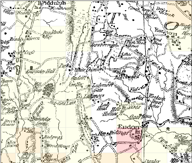
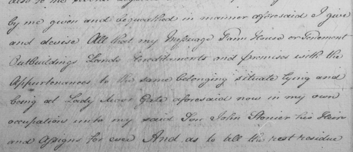
Ladymoor Gate Farm is an old farm house with a range of out buildings that, we are told were build between 1800 and 1820. The earliest reference we have found to it so far is 1806 when it was mentioned in the will of William Stonier. However a building on the same site is clearly shown on Yate's 1775 map.
The extract from the Yates Map is reproduced here courtesy of National Library of Scotland. If you wish to explore the map further it is searchable here. To navigate to the section shown select Biddulph and move map so that "Biddulph" is at the top one-third across from left to right and Ladymoor Gate will be near the centre).

We can't be sure it is the same original building although we learned from a local historian that the all wooden fastening pegs and absence of nails used in the construction of what remains of the original roof means it is unlikely to be later than first decade or so of 19th century.
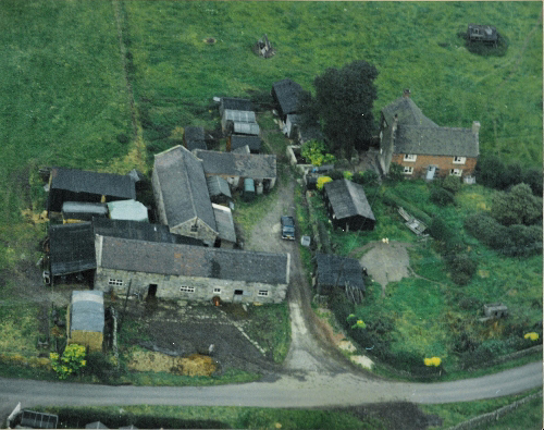
The house has clearly been extended several times since it was built (including once by us in 2001) but some of the original features, for example the wooden beams and roof timbers, are still evident. See the ariel view of Ladymoor Gate in 1972.
We do know something about the previous occupants and a good way to follow the history of the house is by reading about the families who lived here. Like many of the people who lived in this area, the 19th century occupants of our house were farmers and in 1851 the holding was 92 acres, but by the beginning of the 20th century the opportunitues of the local mining industry were having an impact and by the end of the 19th century the holding was down to 30 acres. It is now a mere 7 acres (approx 2.8 hectares).

Ladymoor Gate Arial View 1972
To find out more about the history of the Ladymoor Gate I obtained the original conveyancing and other deeds. After I registered the property in 2007 they are no longer of legal significance but, at least to me, they are very interesting historical documents. The oldest manuscript is a deed from made in 1906. It documents mortgage and conveyance transactions back to 1872 when Richard Harrison mortgaged the property to William Tatton, a silk manufacturer from Leek.
The census records were our starting point for identifying the previous occupants of Ladymoor Gate and while we were searching we noticed the same family names appearing, disappearing, re-appearing and we also saw the farm sizes gradually reduce and the number of dwellings increase. This has spurred on our interest to look into the area that was previously the district of Crowborough and Blackwood.
As a first phase we have begun to compile census information and hope to plot the movements of the people and the re-allocation of the land or their move from rural to town and possibly into the pottery or mining industries. Mining played a significant role in the history of the people who lived in and around the Brown Edge area.
For a good local history of mining with an interesting audio collection try Coal mining in North Staffs from Keele University multi media archive.
For what life may have been like for the early occupants of Ladymoor Gate see Britain between 1801 and 2001 and Staffordshire Moorlands maps, statistics, descriptions and more (From A vision of Britain through time)


